


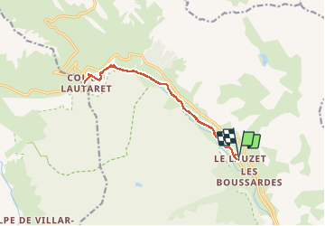
lauzet col du lautaret

jean-charlesSIMAND
User

Length
13.4 km

Max alt
2063 m

Uphill gradient
426 m
Km-Effort
19.1 km

Min alt
1654 m

Downhill gradient
418 m
Boucle
Yes
Creation date :
2014-12-10 00:00:00.0
Updated on :
2014-12-10 00:00:00.0
1h33
Difficulty : Easy

FREE GPS app for hiking
 SityTrail
IGN / Geographical institutes
SityTrail Plus
The world is yours!
About
Trail Running of 13.4 km to be discovered at Provence-Alpes-Côte d'Azur, Hautes-Alpes, Le Monêtier-les-Bains. This trail is proposed by jean-charlesSIMAND.
Description
super
Positioning
Country:
France
Region :
Provence-Alpes-Côte d'Azur
Department/Province :
Hautes-Alpes
Municipality :
Le Monêtier-les-Bains
Location:
Unknown
Start:(Dec)
Start:(UTM)
300140 ; 4987678 (32T) N.
Comments